
Transforming DuSable Lake Shore Drive into a Boulevard.
What’s a Transit Boulevard?
Example of a transit boulevard from the National Association of City Transportation Officials
A transit boulevard is a high-capacity roadway served by all transportation modes including pedestrians and cyclists, drivers, and transit users. Boulevards often feature dedicated or enhanced transit services like bus rapid transit (BRT) or light rail transit (LRT), wide sidewalks, and high–quality bike lanes. Boulevards incorporate significant beautification elements like multiple rows of street trees and furniture like benches or commercial kiosks. They’re also more efficient, safer, and quieter than access-limited highways like DLSD, which are designed only for vehicles and speed.
Boulevards are comfortable, attractive, and efficient ways to move a lot of people through dense urban areas. They have small overall footprints compared to access-limited highways and incorporate features serving multiple transportation, community, and economic development needs. Transforming the drive into a boulevard would reduce vehicle speeds, increase safety, improve mobility, reduce emissions and noise pollution, and expand parkland.
We believe this vision is possible now. Several ongoing and planned transit investment projects will significantly increase capacity and service quality in Chicago, including the Red-Purple Modernization, the Red Line Extension, Metra’s transition to regional rail, and the proposed bus rapid transit on Western Avenue. Additionally, 60% of drivers surveyed by IDOT who use DLSD have expressed interest in switching to transit if services were improved. Biking has also exploded in popularity in recent years, and the city is increasing investment in cycling to sustain this momentum. There is significant demand from the public to choose alternative transportation options.
Back to top
Prioritizing Transit
A lot of people travel along the lakefront corridor. The best way to move a lot of people through dense urban communities is by prioritizing high-capacity, high-quality transit. It can move more people using less space than vehicles alone. Transit needs priority on the road, however. This means building transit services like BRT or light-rail with travel lanes for transit vehicles only, high capacity stops and stations, and priority getting through intersections. Transit investment within the DLSD corridor and adjacent corridors is critical to allow fewer people to drive.
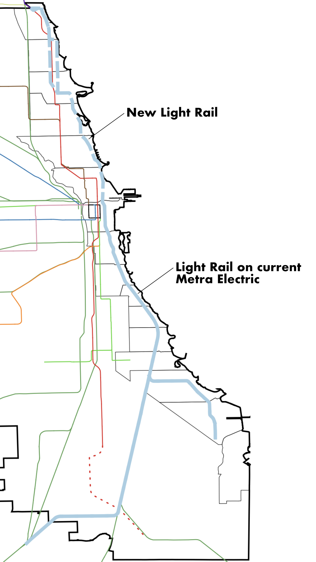
To help enough people make the shift from their car to transit, we propose a series of transit investments including a lakefront light rail line running from the North Side to the South Side. A lakefront light rail line can be built as part of the North DuSable Lake Shore Drive reconstruction project and connected to the existing Metra Electric District rail-right of way. This would improve mobility across the region, by increasing transit access between north and south lakefront neighborhoods, connecting residents to popular destinations, and improving transit operations by moving more people with fewer operators.
Many short- and medium-term improvements can help support transportation mode shift from cars to transit. This includes ongoing projects like the Red-Purple Modernization and Red Line Line extension, which will increase L capacity on the North Side and add service on the South Side. New infill stations can be added to the Metra Union Pacific North Line to increase access to that important regional rail service. The development of the Western BRT will further support the shift to transit. Adding bus terminals at the lakefront will also improve east-west connections.
Longer term projects include developing a city-wide network of BRT lines, including critical east-west lines, transitioning the full Metra system to a regional rail model, and reforming state transit funding and governance.
Back to top
Walking, Rolling, and Biking Upgrades
Boulevards are great for people walking, rolling, or biking, because they feature wide sidewalks, ample street furniture like benches, high-quality bike lanes, and lots of street trees for shade. Replacing DLSD with a boulevard will increase safety and accessibility for pedestrians and cyclists–and drivers. Boulevards slow drivers down, reducing speeding and unsafe driving behavior. Pedestrians and cyclists will also be able to cross DuSable Lake Shore Boulevard at more points and without needing to use dark underpassess or difficult to access overpasses. This will create more access to the parks and make those access points more accessible to people with disabilities.
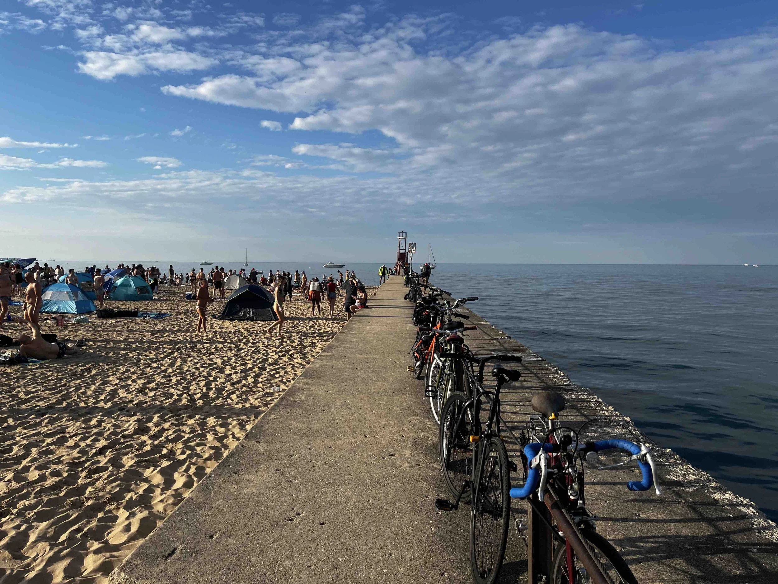
Walking, rolling, and biking are great for short trips within and between neighborhoods, and more people than ever are choosing these options. A boulevard with improvements for pedestrians and cyclists would increase mobility by enabling more people to walk, roll, or bike to destinations in their neighborhood. This will also reduce congestion and conflict on the Lakefront Trail, which currently provides one of the few safe spaces to bike between lakefront neighborhoods. Many people use it as a transportation route, and creating new facilities would relieve pressure on the trail.
Back to top
Increasing Parkland
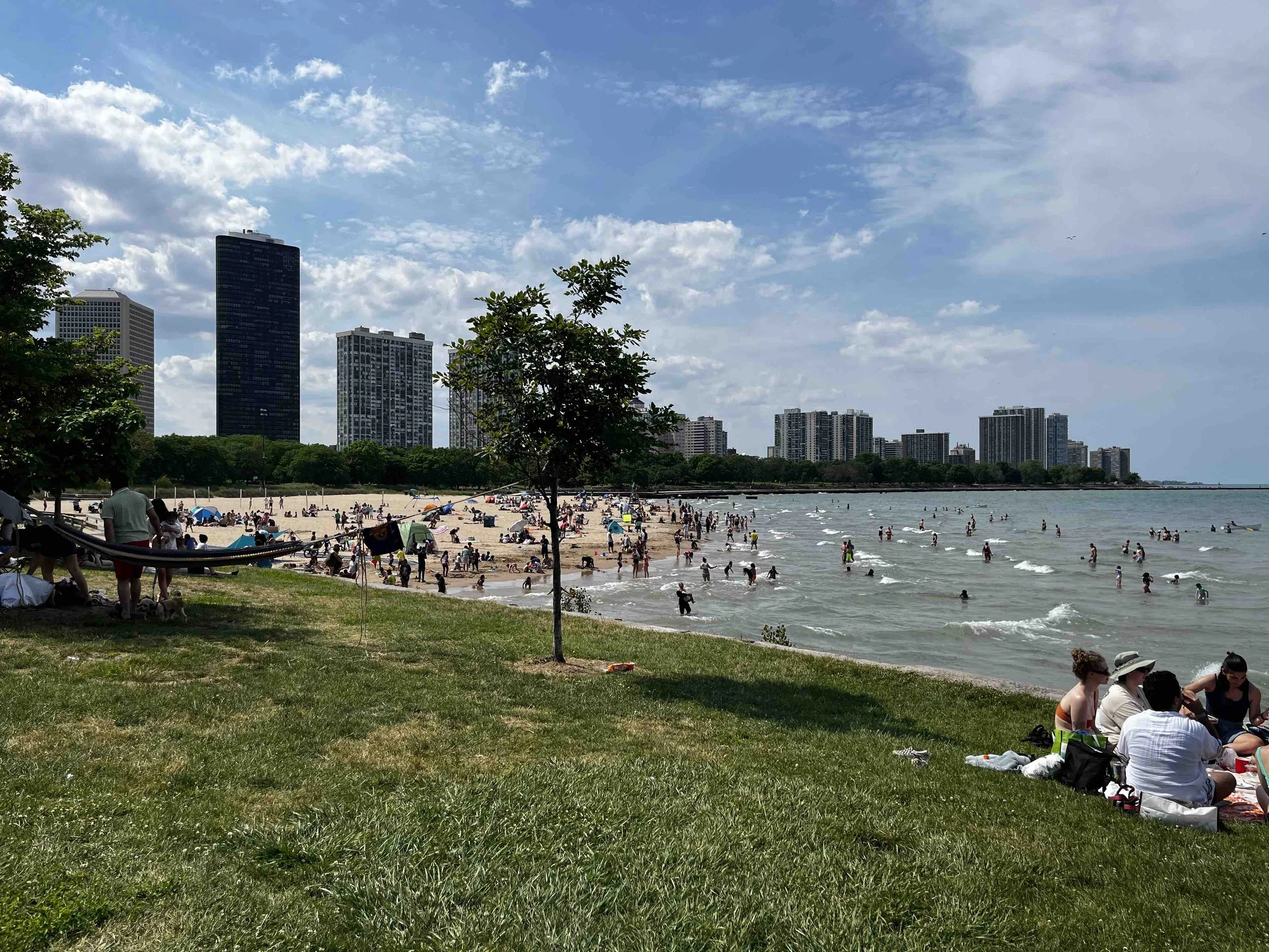
By prioritizing transit and transportation modes like walking, rolling, and biking, hundreds of thousands of people can move through a smaller space than a limited access expressway. Transforming DLSD into a boulevard would free significant amounts of land to be restored as parkland and natural areas. This means more amenities and green infrastructure, passive and active landscapes, and greater climate resiliency.
Investing in transit, walking, rolling, and biking, could mean a traffic lane in each direction could be removed from DLSD (two total). Narrowing lanes to 10 ft would also reduce driving speeds and increase safety. This would free up 10-25 acres for parkland restoration along the 7.5 Redefine the Drive project corridor. Removing grade-separated junctions (i.e., freeway on-/off-ramps) would free-up approximately 1.5 acres per ramp, or 40-45 acres for parkland restoration in this corridor. Ending DLSD at Foster Avenue would allow an additional 22 acres of parkland restoration between Foster and Hollywood Avenue.
By transforming DLSD into a proper boulevard, we can add 100 acres or more of parkland along the lakefront – without filling in the lake. That’s roughly the size of Northerly Island.
Back to top
Designing for Safety, Not Speed
The current posted speed limit on DuSable Lake Shore Drive is 40-45 mph, but the expressway is designed for much higher speeds. Almost all drivers speed on DLSD as a result. Rebuilding DLSD as a boulevard will ensure drivers stay at or below the posted speed limit.
Speed matters. The faster a vehicle is moving the more likely a fatality will occur in an accident regardless of whether a person is inside or outside the vehicle. For pedestrians and cyclists, the chances of being killed by a driver increases exponentially with speed. At 20 mph, there’s a one-in-ten chance a person struck by a vehicle will be kills. That doubles to five-in-ten chances at 30 mph, and nine-in-ten at 40 mph. It is essential we keep vehicle travel speeds below 40 mph on city streets and roads.
Per city ordinance no “roadway or expressway…shall be permitted in the lakefront parks.” Expressways are defined as “any primary highway constructed as a freeway which has complete control of access and is designed for speeds in excess of 45 miles per hour.” It’s time the city and state adhere to the municipal code, move DLSD out of the parks, and rebuild it as a boulevard designed for slower travel speeds.
Back to top
What Could a DuSable Lake Shore Boulevard Look Like?


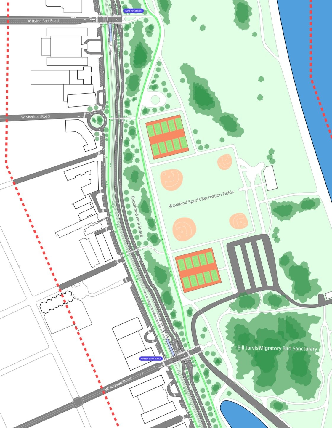
Addison Street
A boulevard would allow for new access points to the lakefront for pedestrians, cyclists, and drivers, while creating a calmer and safer environment. Service drives would preserve access for residents along the drive and prevent dangerous cut-through traffic.
New multi-use paths would provide better neighborhood connectivity, and create a quieter streetscape.
Proposed conditions
Current footprint
Lincoln Park Zoo


By shifting the drive to its historic alignment, we could create large amounts of new serene parkland and better protect our shoreline from erosion using native plants and dunes.
Lincoln Park Zoo would now have a world-class transit connection, making it better accessible to the rest of the city.
Proposed conditions
Current footprint